


Warmer Days Ahead
Tonight: Mostly Clear| Low: 40 | Light
Tomorrow: Above Avg. Temps, Few Clouds | High: 68 | SSW 15 G 25+
In Depth:
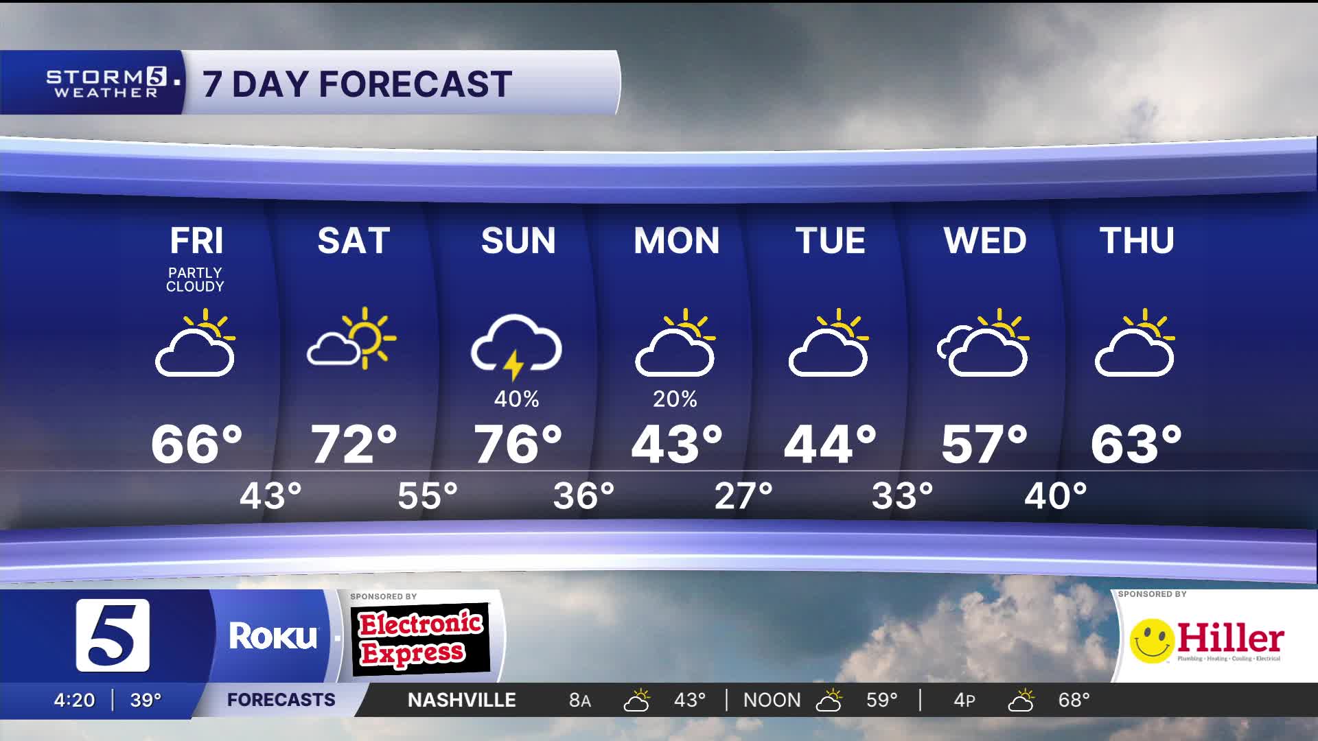
It was a beautiful end to the work week with warmth and sunshine to continue Saturday. Tomorrow will remind you that spring is right around the corner, with highs reaching the low 70s.

Sunday will be very windy. To start, winds will be out of the south, warming highs into the mid to upper 70s. Overnight, a cold front will move across Middle Tennessee and southern Kentucky. Some storms could be strong to severe which is why we've issued a Storm 5 Alert.
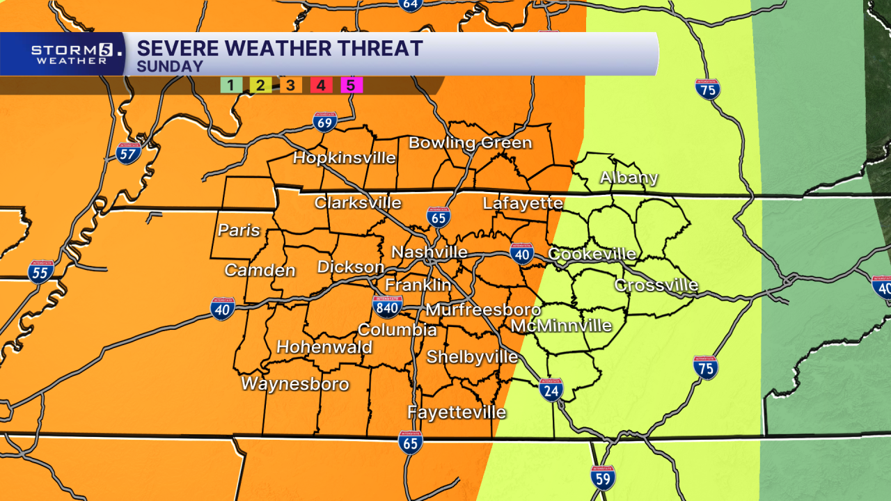
The main concern continues to be damaging wind gusts, with the chance for 75 mph wind gusts. Quick, spin-up tornadoes along the front can't be ruled out either.
As of right now, the timing looks to be overnight Sunday into Monday morning. This cold front is so sharp we could even see a few flakes flying Monday morning, followed by a hard freeze Tuesday morning!
