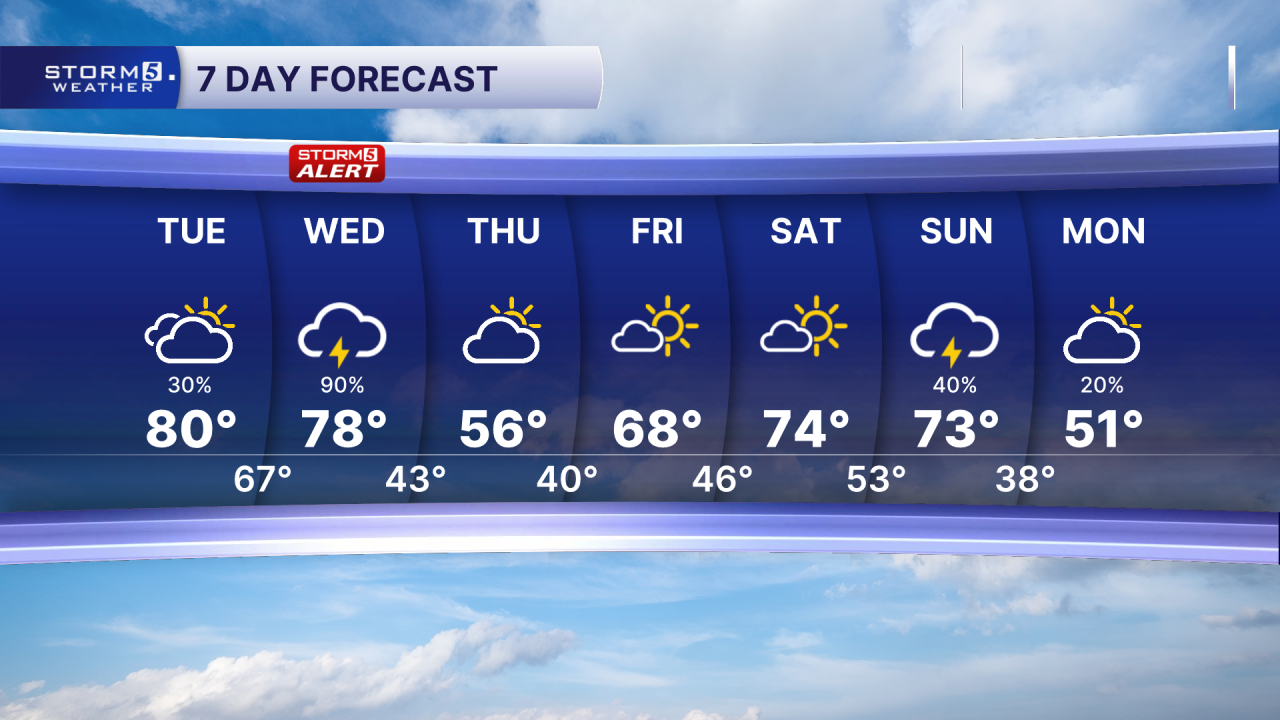
Warm and unsettled through midweek
Forecast:
Tonight: Scattered Showers | Low: 63 | SSW 5-10
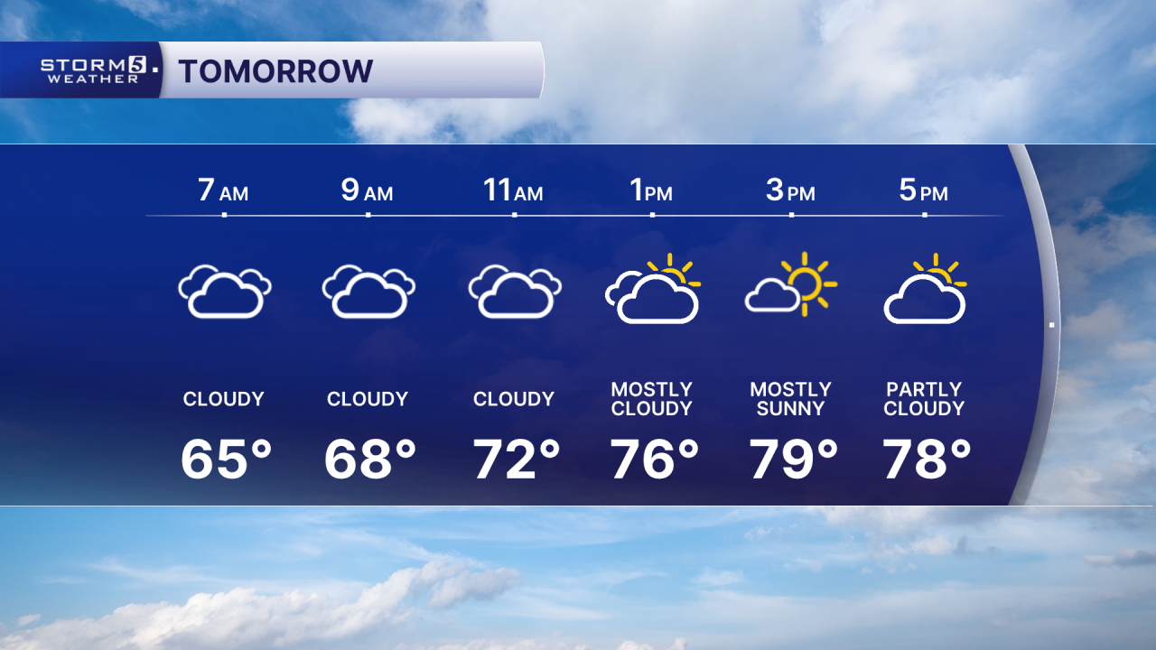
Tomorrow: Scattered morning showers, partly cloudy afternoon | High: 80 | SW 5-15
In Depth:
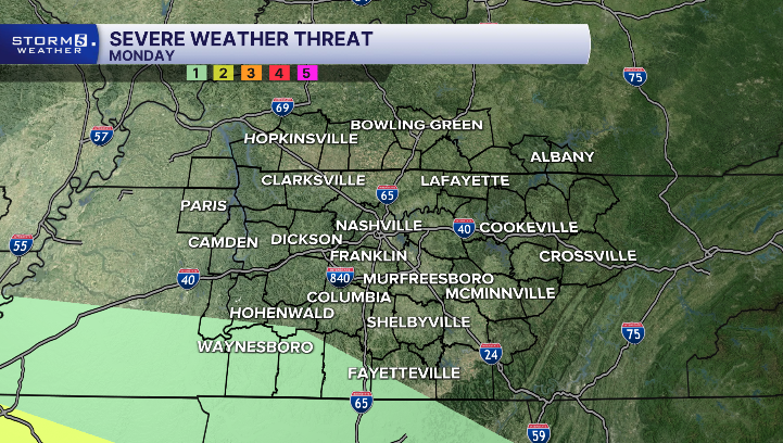
A disturbance is moving in from the southwest prompting some showers and thunderstorms. The severe threat is low, but not zero. Locations in Decatur, Wayne, Lawrence, and Giles counties have a slightly higher chance for strong storms. Main concerns include damaging wind gusts and small hail.
Scattered showers are possible overnight, especially east of I-65. Tuesday morning is cloudy, we get a small break from our storm chances, with mostly dry conditions, breezy winds, and a warm afternoon with highs in the upper 70s to low 80s.
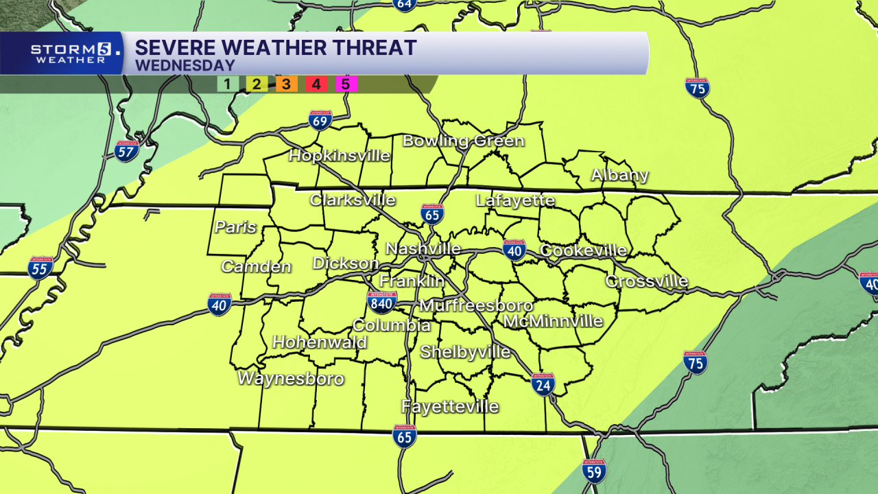
Another strong system will push a cold front into the region on Wednesday. It brings our highest chance for storms this week, prompting a STORM 5 WEATHER ALERT. A few storms could become severe, with the main concern being strong winds. But a quick spin up tornado can't be ruled out.
The front brings cooler air for Thursday, with highs in the mid-50s.