

One More Round of Rain to Start Monday, Before a Dry Stretch Sets Up
Forecast:
Tonight: Mostly Cloudy with Spotty Showers & T-Storms, Areas of Fog | Low: 68 | ESE 2-7
Tomorrow: Sct'd Showers & Storms thru Midday, Spotty PM Shower | High: 85 | ENE 2-7
In-Depth:
Through the evening we will have scattered showers and storms around the area so make sure you have a quick back-up plan if storms pop-up in your area.
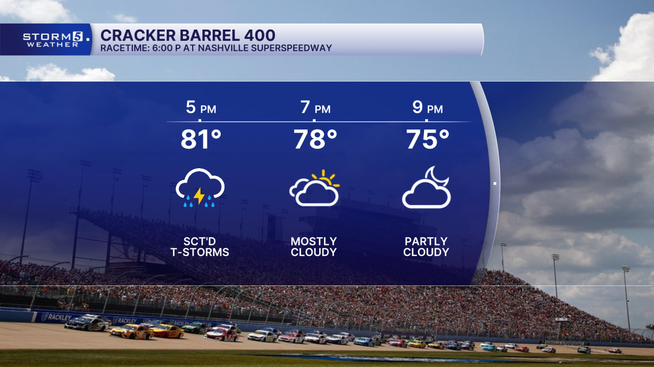
If you are heading to the Nashville Superspeedway for the Cracker Barrel 400 it's a good idea to take a poncho as you could have scattered showers and storms around for tailgating, and the start of the race.
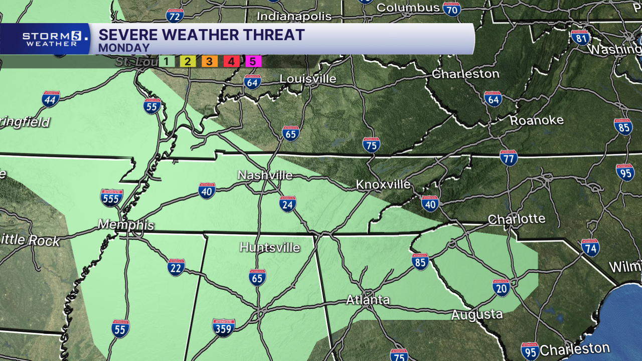
Another wave of rain and storms moves in from the northwest as we start off our Monday. The rain will quickly race to the southeast by early afternoon, leaving partly cloudy skies and spotty rain possible into the evening hours.


Temperatures will top out in the mid 80s.

An isolated strong to severe storm is possible with gusty winds the main concern.
A ridge of high pressure builds into the area Tuesday through Friday, finally bringing a dry stretch to the Mid-State.

