
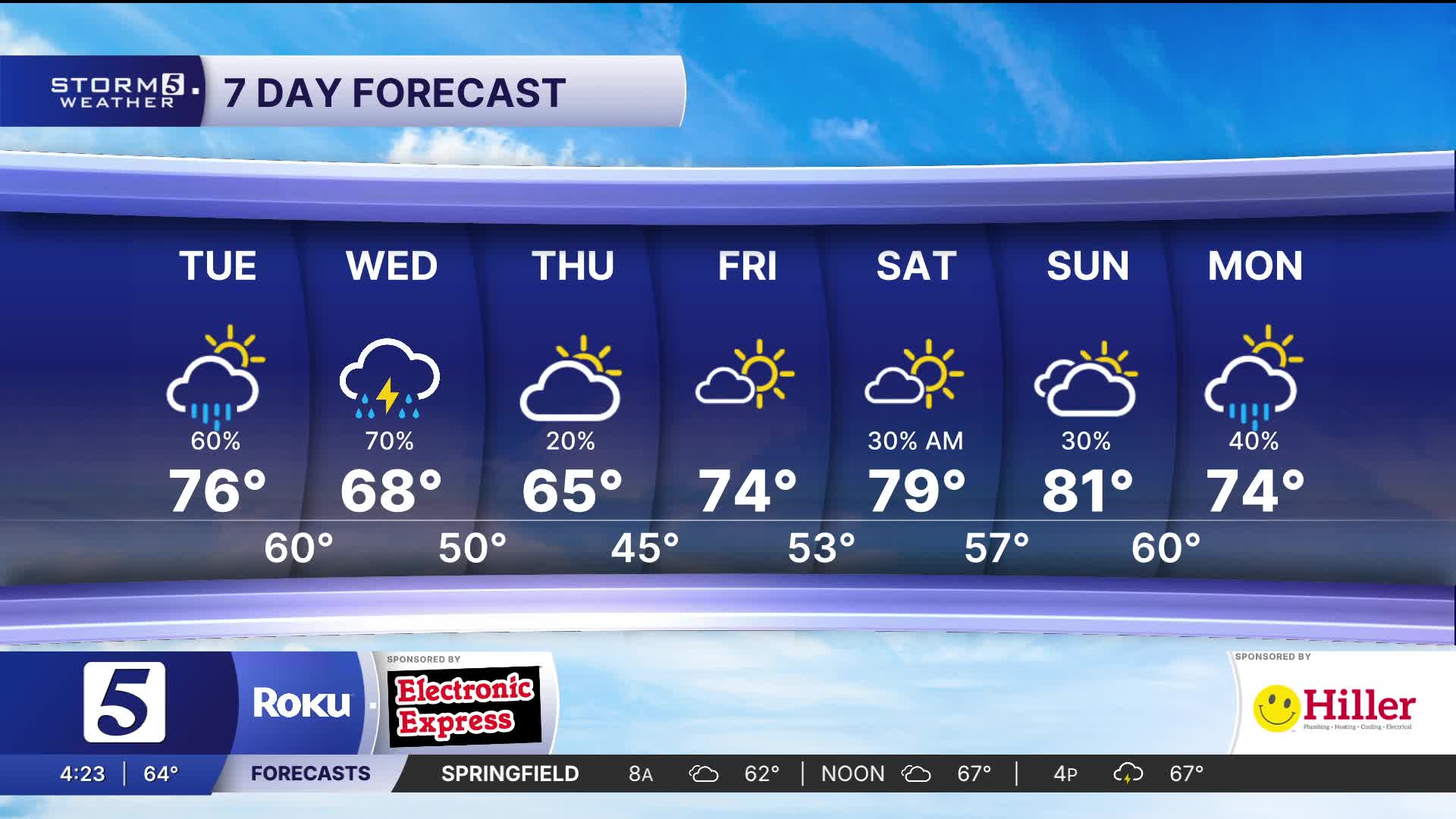


Unsettled Pattern the Next Several Days
Forecast:
Tonight: Showers & Storms | Low: 58 | S 10-15, Gusts 25 mph
Wednesday: Showers & Storms | High: 65 | NNW 5-15
In depth:
We are in desperate need of liquid sunshine and multiple opportunities for showers and thunderstorms are forecasted the next several days. Overnight into Wednesday much of Middle Tennessee, and areas south are under a Marginal Risk (1 out of 5) for a strong to severe storm.

Showers and storms overnight will bring much needed, heavy rain at times. Scattered showers and storms will continue through Wednesday.


Given how dry the ground is, and heavy showers in the forecast, we cannot rule out isolated spots were flash flooding could occur. Between now and Thursday morning we will see between 1"-3" of rain, with isolated areas picking up a little more, and other isolated spots a little less.

