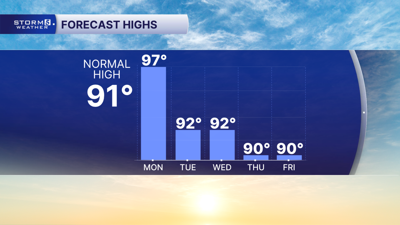
Another Day of Dangerous Heat
Forecast:
Today: Hot & Humid, Sct'd Afternoon & Evening Storms East of I-65 | High: 97 | WSW 5-15
Tonight: Decreasing Clouds | Low: 68 | NNW 5-10
Tuesday: Near Seasonal Temps & Sunny | High: 92 | NNW 5-10
In Depth:
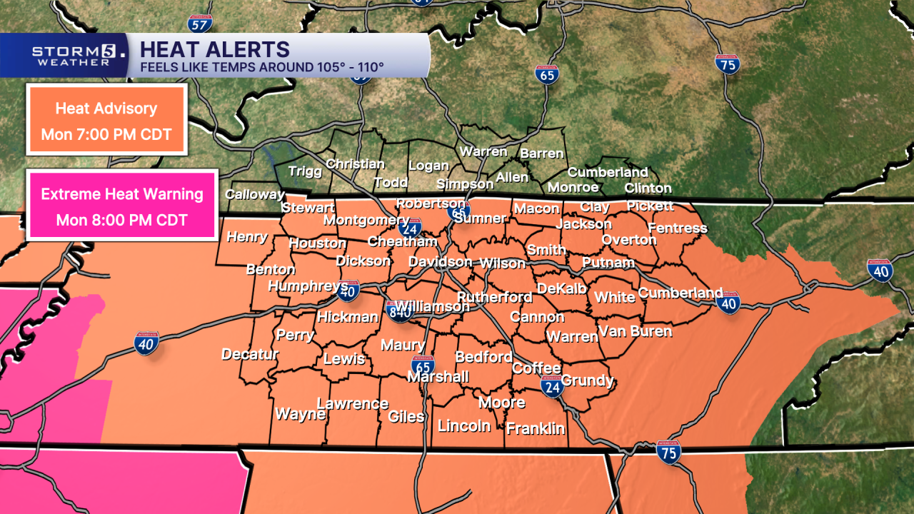
We aren't out of the woods just yet when it comes to the dangerous heat. A Heat Advisory remains in effect for the entire Mid-State through 7 p.m. Monday as heat index values, or "feels like" temperatures, climb to around 105 degrees.
Relief is on the way, but not before a cold front brings the chance for a few showers and thunderstorms Monday afternoon and evening. The greatest storm coverage is expected east of Interstate 65, including parts of the Cumberland Plateau.

A few storms on the Plateau could become strong to severe, capable of producing damaging wind gusts and torrential rainfall. Heavy downpours may also lead to localized flash flooding in areas that receive repeated rounds of rain.

Behind the cold front, a less oppressive air mass will settle across Middle Tennessee. High temperatures will return closer to seasonal averages, reaching the lower 90s for much of the week, along with slightly lower humidity levels.