


Storm 5 Alert Friday
Forecast:
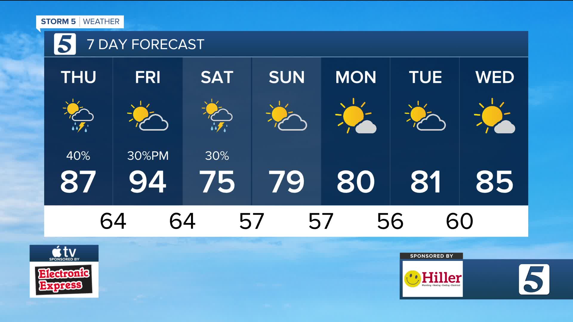
Tonight: Mostly Clear w/ Patchy Fog | Low: 68 | S 1-6
Friday: Mo. Sunny then Pt. Cloudy, Increasing Shower and Storm Chances PM, Few Storms May Be Strong/Severe | High: 94 | SSW 5-15
In Depth:
Quiet weather will start our Friday, but by the afternoon and evening a cold front brings the threat for strong to severe storms across the NewsChannel 5 coverage area. All of the area is under a risk for a strong storm.

WTVF
The main concern wtih any storms will be damaging wind and frequent lightning followed by small hail. While chances are extremely low they are note zero when it comes to the chance for an isolated tornado. The window for the threat looks to be 3pm-10pm.

WTVF
