


NASHVILLE, Tenn (WTVF) — A Storm 5 Alert for possible severe weather in Middle Tennessee has expired as of 7 p.m. Thursday.
Current Conditions
- Humidity: 94%
- Dew point: 70°
- Pressure: 29.78 in
- Wind speed: 5 mph
- Wind direction: WNW
- Visibility: 6.0 mi
- Sunrise: 05:54 AM
- Sunset: 07:51 PM
A Storm 5 Alert will be in effect on Thursday afternoon as a fast-moving line of storms moves through Middle Tennessee.
A large portion of the region will be under an enhanced risk (3 out of 5) for severe storms, while our Kentucky and more eastern counties are under a slight risk (2 out of 5).

Conditions will stay very windy throughout Thursday as a potent cold front moves through the area. You can expect widespread showers with some thunderstorms possible from late morning through the early evening hours.
A couple of storms may be strong to severe with damaging wind as the main threat. An isolated tornado cannot be ruled out. Because the line of storms will be moving so fast, it will reduce the lead time on tornado warnings. If they form, they will form quickly and be moving at highway speeds. Don't hesitate to shelter if a warning is issued.
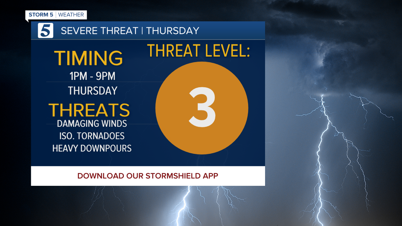
You may see locally heavy downpours as well, with up to an inch of rain expected in some areas.
Timing for these storms is between 1 and 9 p.m. The strongest wind and strongest storms will be along Interstate 65 between 3 and 5 p.m. — meaning the afternoon commute could be impacted.

It's going to be windy all day long with wind gusts as high as 45 to 50 mph, even when it's not raining. The entire region is under a Wind Advisory on Thursday.

When the line of storms comes in, they will be capable of 70+ mph wind. The line of storms will be moving at 70 to 80 mph.

Once all this moves out, you can expect a return to cold air on Friday.
Stick with the Storm 5 Weather team for updates, and you can use the tools below to track the storms as they move through the area Thursday.

