


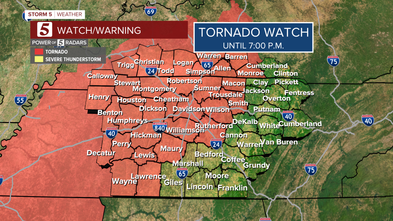
STORM 5 ALERT UNTIL MIDNIGHT
We are monitoring tornado warnings live. Watch with us.
TIMING: UNTIL MIDNIGHT
THREATS/IMPACTS IN ORDER: Damaging Wind, Heavy Downpours, Flash Flooding, Isolated Tornadoes, Hail
We are tracking a strong cold front that will bring the threat of strong to severe storms on Saturday afternoon and evening. All of Middle Tennessee and Southern Kentucky are under a risk for severe storms, with the majority of the NewsChannel 5 viewing area under a Slight Risk (2 out of 5) for severe storms.

Storm 5 Alert Today
Forecast:
Today: Cloudy & Breezy, Sct'd Strong to Severe Storms Possible | High: 66 | S 10-15
Tonight: Cloudy w/ Storms Early, then Becoming Partly Cloudy | Low: 40 | NW 5-15
Sunday: Partly Cloudy, Turning Mostly Sunny | High: 46 | NW 5-10
In-Depth:
You need to remain weather-aware on Saturday as a cold front heading towards the area will bring the threat for strong to severe storms ahead of it Saturday afternoon and evening. All of the NewsChannel 5 viewing area is under a Slight Risk (2 out of 5) for severe weather.

Highs Saturday will top out in the mid-60s, but Sunday will be much colder behind the front with highs only in the 40s!

