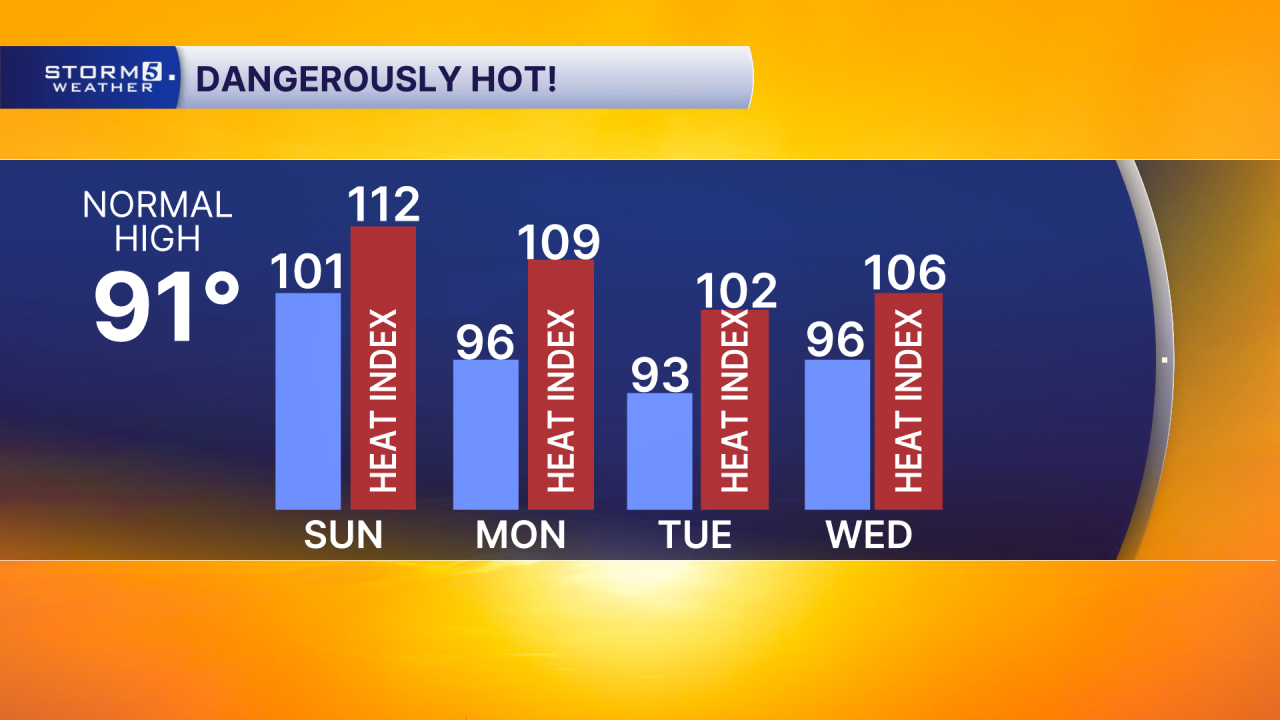
Triple Digit Heat Continues
Forecast:
Today: Hot & Humid | High: 101 | WSW 5-10
Tonight: Muggy & Clear | Low: 77 | WSW 2-7
Monday: Hot & Humid, Sct'd Afternoon Storm Chances | High: 96 | WNW 5-10
In Depth:
Oppressive heat and humidity will continue across the NewsChannel 5 viewing area today as an Excessive Heat Warning and Heat Advisory remain in effect until 7 p.m. Afternoon heat index values are expected to climb above 110 degrees, with some locations experiencing even higher "feels like" temperatures.

If you're planning to attend the Nashville Sounds game at First Horizon Park this evening, take precautions against the heat. Be sure to drink plenty of water before heading to the ballpark and continue staying hydrated throughout the game. Conditions will remain hot and muggy well into the evening hours.

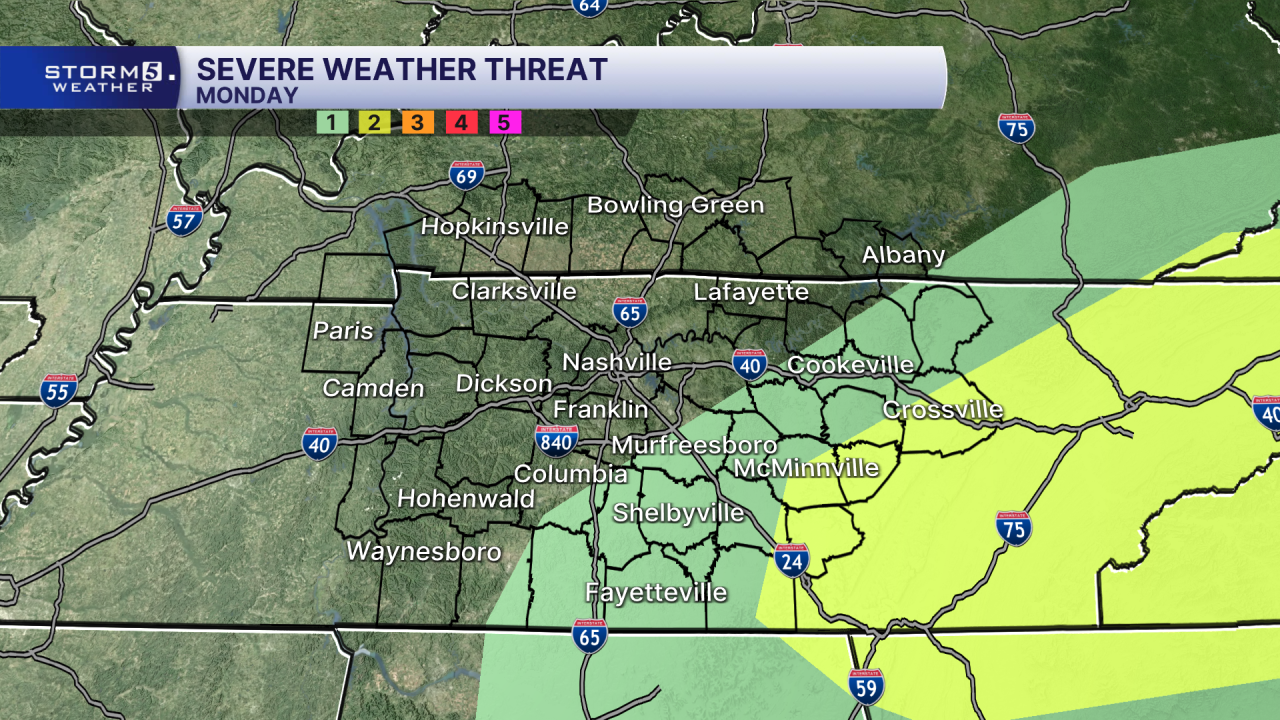
Looking ahead to Monday, we finally have a chance for some relief. A weak cold front will move into the region, bringing scattered showers and thunderstorms during the afternoon and evening. A few storms could become strong to severe, with damaging winds and heavy downpours serving as the primary threats. The greatest risk for stronger storms appears to be across areas east of Interstate 65.
While the front will bring an increase in rain chances, it won't deliver much of a cool down. High temperatures are expected to remain in the 90s through much of the upcoming week, with heat index values continuing to reach the triple digits.