


Humidity Increase Today, Storm 5 Alert Tonight
Forecast:
Today: Partly Cloudy & Humid, 30% Sct'd Storm Chc. | High: 93 | S 5-10
Tonight: Strong to Severe Storms Possible, Storm 5 Alert | Low: 71 | SW5-10
Thursday: Humid, Mostly Cloudy w/ a Chc. for Spotty Showers / Storms | High: 93 | SW 5-10
In Depth:
After a brief break from the muggy conditions, humidity levels will begin climbing again today as the next round of storm chances approaches. While a few isolated showers and thunderstorms are possible during the day, the greater concern arrives overnight as scattered strong to severe storms move into Middle Tennessee and Southern Kentucky after midnight. Due to this threat, the Storm Prediction Center has placed much of the region under a risk for severe weather tonight.
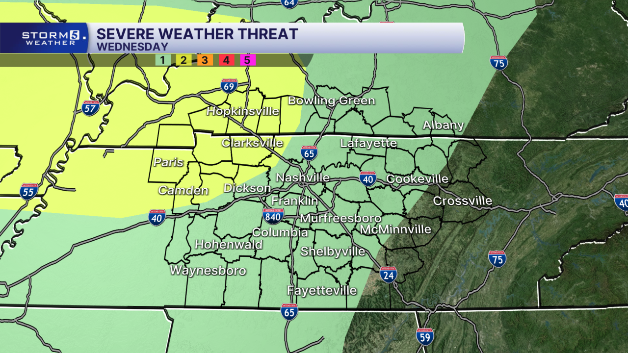
The primary hazards with any stronger storms will be damaging wind gusts and heavy rainfall, which could lead to localized flash flooding, especially in low-lying and flood-prone areas. There is also a low-end risk for hail and a very low threat for an isolated tornado.

The greatest potential for strong to severe storms will begin around midnight as activity pushes into the Mid-State and Southern Kentucky. Storms are expected to continue through the overnight hours and could impact the Thursday morning commute before gradually weakening later in the day.


