


Storm 5 Alert through late evening
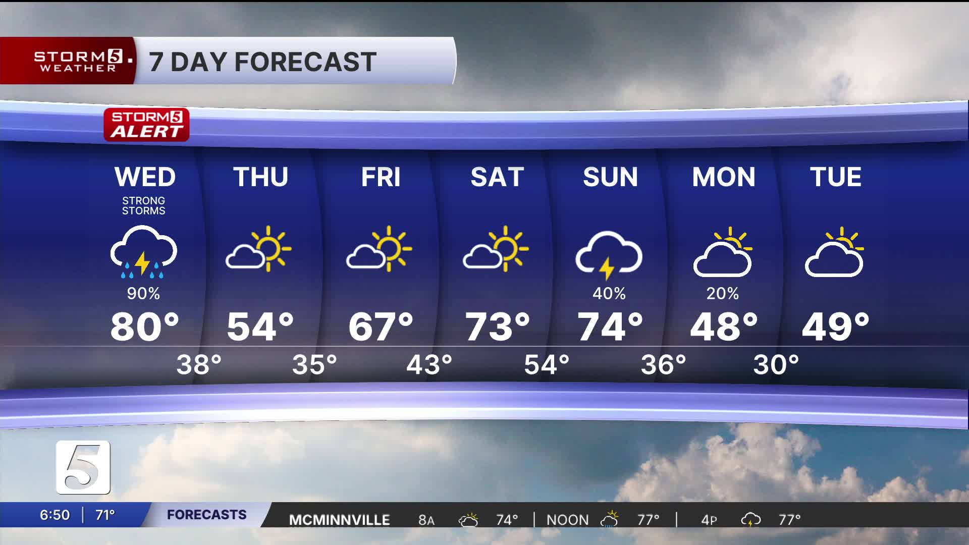
Forecast:
Today: Morning Clouds, Showers & Storms, Severe Possible | High: 79 | SW 5-15
Tonight: Mostly Cloudy, Storms Move Out| Low: 67 | SSW 5-15
In Depth:
The Storm 5 Weather Team has issued a Storm 5 Alert for Wednesday due to the threat of severe storms in the afternoon and evening hours. A strong cold front will move into the mid-state, bringing widespread showers and storms to the area.
The timing of our system looks to be a little earlier. The faster it moves in, the shorter amount of time clouds will have to move out. We want to keep the cloud cover because sunshine helps fuel instability.
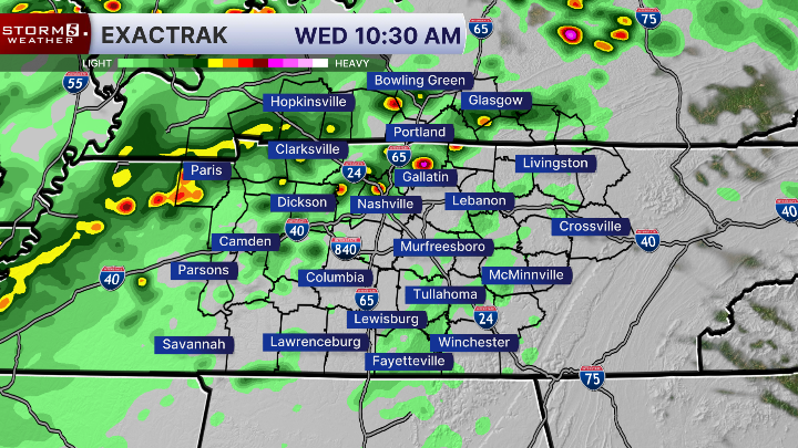

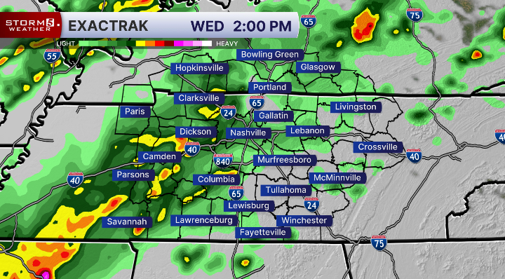


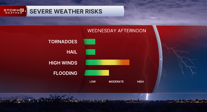
The Storm Prediction Center (SPC) has all of Middle Tennessee and Southern Kentucky under a Slight Risk (2 out of 5). This is not anticipated to be a widespread severe event. However, we look to see a handful of severe storms.
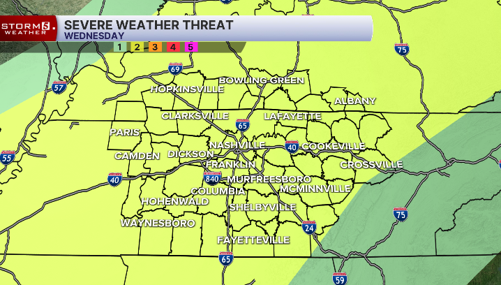
The main concerns include damaging wind gusts, straight-line winds, and localized flooding. The hail and tornado threat is low, but not zero.
The front will bring cooler air for Thursday, with highs in the mid-50s. Another cold front will move through Sunday evening, bringing a chilly start to next week. Yes, we are talking about morning lows in the upper 20s to low 30s.
