
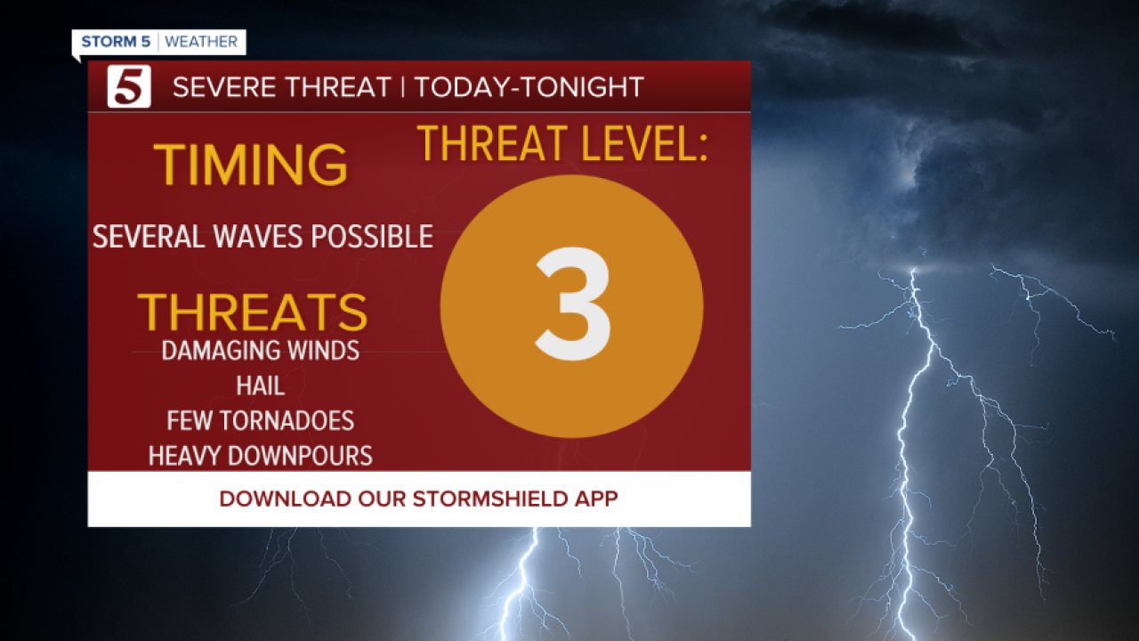


Storm 5 Alert Today Through 7 AM Monday
Strong to Severe Thunderstorms will Develop with Damaging
Winds, Hail, A Few Tornadoes and Heavy Downpours ALL Possible!
Forecast:
This Afternoon: Sun/Clouds Mix, Scat. Showers & Storms, Some Storms
May be Strong to Severe |High: 89 | S 10-15, Gusts: 25 mph
Tonight: Area Rain & Storms, Some Storms May be Strong to Severe|
Low: 70| S 10-15, Gusts: 25
Memorial Day: Early Morning Strong to Severe Storms then Clouds
Decrease, 20% Shower & Storm Chance During the Day |High: 85|
W 5-10, Gusts: 20 mph
In Depth:
Stay Weather Aware Today & Tonight!
Several waves of rain and thunderstorms will move across the region
today and tonight bringing the chance for strong to severe storms.
The highest chance will happen overnight, but don't let your guard down
with any storms that develop during the day.

All of Tennessee and Kentucky have a risk of severe weather from now
through Monday morning.

This graphic shows that there is a tornado risk across the entire region
as well. While this shows the chance of a tornado within 25 miles of any
point on the map, I want to emphasize the risk is there for the entire
NewsChannel 5 area, and we have had strong tornadoes in the past with
just a 2% risk.

With heavy downpours possible, this could lead to some localized
flooding. Also, Excessive runoff may result in flooding of rivers, creeks,
streams and other low-lying and flood-prone locations.

